Wednesday, September 20, 2006
Thameen Darby Creates Nakba Layer for Google Earth
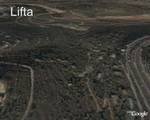
Photos: Lifta, an example of what you'll see on the Nakba Layer for Google Earth.
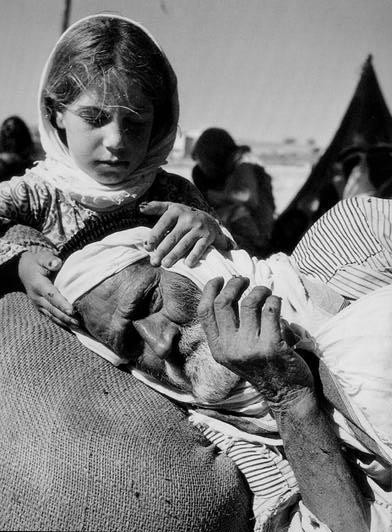
A young refugee girl takes care of her grandfather.
Thameen Darby has created a Nakba layer for Google Earth.
Thameen describes his project that will bring joy to Palestinian refugees:
"Do you want to see where your original town or village is in Palestine? If you have Google Earth you can use the attached layer to see the destroyed and existing Palestinian Villages. For those who have not used it yet, Google Earth is a new emerging tool for information exchange based on a three dimensional assimilation of satellite images of the world. Google Earth allows users to add layers to it after they install. There is a layer of all the destroyed Palestinian villages and towns in 1948. This is a big data base that shows the site of each village and directs you to a website that talks about each village in detail. Download the attachment from http://bbs.keyhole.com/ubb/showthreaded.php/Cat/0/Number/310630/page/.
"If you have Google Earth, open the attachment and it will automatically go to Google Earth and display the layer. If you do not have Google Earth, download the attachment now and keep it until you download the program. It is a very nice program, it is very educational and a lot of fun to see the whole world on your PC.
"You can download Google Earth from here: http://earth.google.com/download-earth.html The Attachment is very small, only 150 Kbs. The attached layer contains a list of all the destroyed villages, around 700 of them, classified according to their district, with links to a website that gives detailed information about each village. Because of the amount of information, the layers are very crowded. So to view a specific subcategory, inactivate the other layers.
"Please forward this attachment and this email to your friends. Many Palestinians will like to see where in Palestine their original hometown is located. "
And Thameen adds:
"The web site palestineremembered.com is working on a more comprehensive project to bring the Nakba online. They are integrating the google earth maps into its data base, and they are using Dr. Salman Abu Sitti's Atlas of Palestine as one of their sources. Soon we will have all the land marks in Abu Sitti's Atlas online. Salah Mansour, the palestineremembered.com webmaster, told me it will be in two or three weeks. Isn't that cool !!"
Let's Not Forget,
Thameen
Very cool. Thanks, Thameen for your extraordinary effort. Thameen exemplifies what my fellow ROR blogger, Akram of Bonsoir always maintains:
TOGETHER WE CAN MAKE A DIFFERENCE!

<< Home
![]()


